The City of Saint Paul hired nationally-recognized professional transportation analysis firms Nelson/Nygaard, SRF Consulting and Utile to conduct a transportation study on how the Ford Site could develop without straining the traffic system in the surrounding neighborhood. This study was conducted to inform the framework for the site and was calculated using maximum resident and visitor calculations to take a conservative approach. A more detailed study of transportation impacts, with the actual proposed development, will be conducted once a master developer puts plans forward.
New development – with a mix of housing, jobs and recreation – will result in new trips to and from the site, though the study found that the impact overall is manageable. The study identified three key transportation outcomes:
- The Ford Site will be designed for equitable and safe access for all ages and modes of travel.
- Vehicle trips from the Ford Site should be minimized to maintain acceptable traffic flows in the area.
- A site-wide shared parking system will consolidate parking for cars, leaving more land for living, working and recreation.
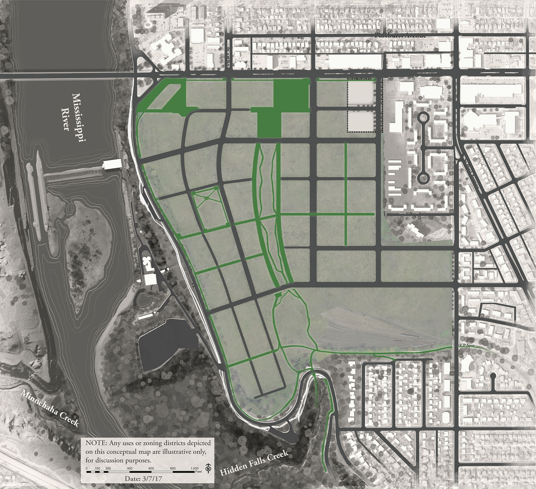
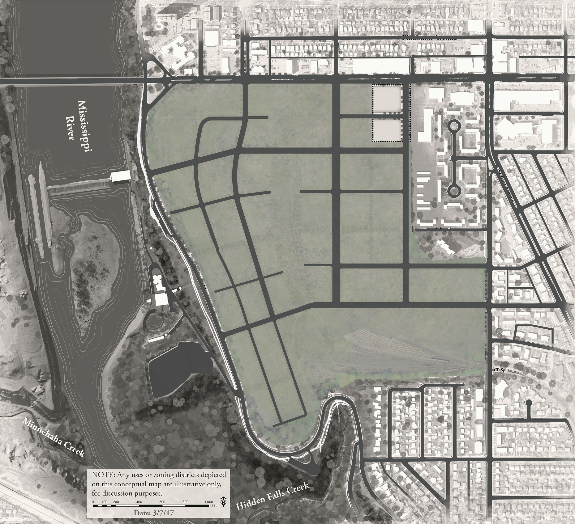
The study confirmed that incorporating a street grid on the site will assist in managing vehicle traffic and provide better connections for pedestrian and cyclists – even when using the maximum possible build-out, with the maximum possible residents on the site.
A robust transportation network will create a connected site that accounts for and enhances the residential element of the existing neighborhood and will ensure a better experience for drivers, pedestrians and cyclists alike – both in and around the site, particularly along Ford Parkway.
The study took into account several transportation trends.
- According to the Federal Highway Administration, 16 to 34-year-olds from 2001 to 2009:
- Took more walking trips (16%)
- Took more biking trips (24%)
- Traveled farther on transit (40%)
- Drove fewer miles (23%)
- A household in multi-family housing takes 30% to 39% fewer car trips than a household in single-family housing, based on national weekday averages.
Streets
- Extending the street grid into the Ford Site will create good connections and disperse trips.
- Cretin and Montreal are the most logical roads to make a connection through the site, given their current function in the roadway network and their capacity to carry more trips. Opening up this connection will reduce pressure on the current pinch point at Ford Parkway and Cleveland Avenue.
- Additional connections at Mt. Curve, Finn and Saunders will provide alternative access points, dispersing traffic and lowering its impacts on any one intersection or road.
- Finn would run between Montreal and Ford Parkway as a small, local street. This presumes that there is potential to redevelop the existing retail properties in the Lunds shopping area, an idea that City staff have discussed with property representatives there. Redevelopment could better relate the properties to the Ford site and improve pedestrian movement in this area of Highland Village.
Bicyclists/pedestrians
- Strong pedestrian/bicycle connections on, through and around the site will encourage more people to walk and bike, instead of driving, for local shopping, recreation, school and work.
- Safety and well-connected pedestrian routes and street crossings are essential for the Ford Site and the surrounding community. All walkways will have an accessible design for people of all ages and mobility, and good winter maintenance will be paramount to support year-round walking.
- Sidewalks will be built along the streets and will be wider in commercial areas to accommodate more people and provide room for sidewalk cafes, benches and plantings.
- Given the higher volume of movement by bicycles and pedestrians between the Ford Parkway bridge, Hidden Falls Regional Park, and potentially a future trail corridor along the Canadian Pacific spur, it is recommended to add a bicycle and pedestrian path on the east side of Mississippi River Boulevard in this segment to complement the trail on the west side.
Transit
Existing transit service near the Ford Site is already strong, with multiple bus routes and the new A-line Bus Rapid Transit. Bringing transit service into the site will make transportation even more convenient for residents, employees and site visitors.
The transit pathway depicted through the site is conceptual. The transit would move north to south along Cretin to Ford Parkway. However, the plan leaves open possibilities for future transit service from the east along Montreal or along the Canadian Pacific rail Ford spur, which is being explored as a possible transit corridor.
Future transit service on the site will be determined by Metro Transit, based on density, local demand, service needs, and funding availability.
Parking
Parking needs will be met on the site through structured ramps in addition to on-street and alley parking. The draft plan calls for parking maximums and minimums for each building to ensure the right balance of parking spaces on the site.
Each building with residential uses will be required to include parking within the same structure. Buildings with non-residential uses would have the option of providing their parking within the same building or sharing parking in a nearby building. Shared, structured ramps are common in commercial districts like 50th and France in Edina or Grand and Victoria in Saint Paul.
Reimagine the Railway: Studying new uses for the Ford Spur
The City, with its consultants Alta Planning + Design, Kimley-Horn and Sambatek, is conducting a feasibility study to reimagine the potential use of a railway that once served the Ford Motor site.
The five-mile corridor has the potential to be remade into a vibrant recreation and transportation resource that can serve Saint Paul residents well into the future. The study will examine opportunities to redevelop the railway to serve pedestrians and bicyclists for decades to come, and it will also consider potential uses for public transit.
Survey work began in March 2017, and robust community engagement and other analysis is expected to extend until March 2018.
Developer transportation study
The master developer selected for the site will be required to conduct a more detailed transportation study which will look specifically at how various development scenarios impact transportation access to, from and around the site, and identify tactics to mitigate any concerns. This will take place as part of a full environmental impact analysis, the Alternative Urban Areawide Review (AUAR). This will likely occur in 2019.