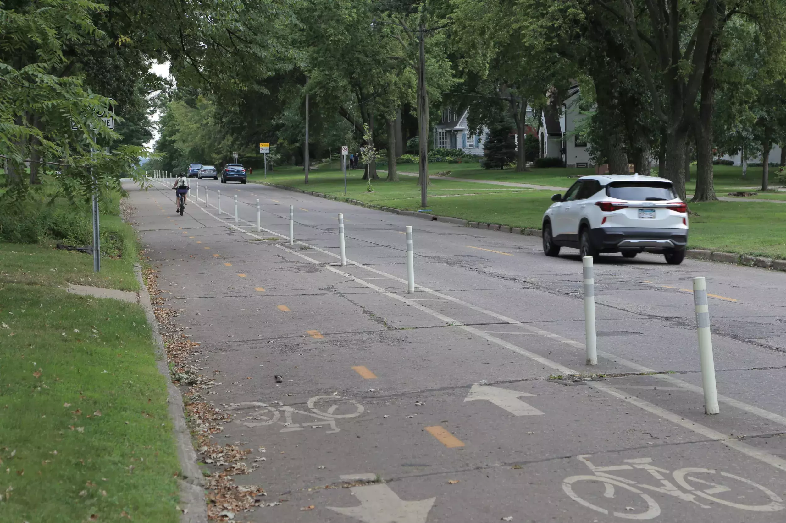
What is the current proposed design of Pelham?
The design will ultimately match the vision described in the Grand Round Design and Implementation Plan (2017): an off-street bikeway on the east side of Pelham, new sidewalk, improved lighting, pavement, utilities, and improved traffic and pedestrian safety. A median refuge island is planned for the intersection of Doane and Pelham.
Why is Pelham shifting 14 feet to west between Mississippi River and north of Otis?
This shift is planned to fit a sidewalk in where it is missing. There is no sidewalk on the east side of Pelham between Beverly and Mississippi River Boulevard (MRB). The City of Saint Paul has a practice of filling gaps in the sidewalk network, especially on collector and arterial streets. The reconstruction of Pelham gives the city an opportunity to fill sidewalk gaps efficiently as part of a larger project. The addition of a sidewalk between Otis and Beverly is straightforward. However, on the block between Otis and MRB, there are significant challenges with the existing slopes and grades. To fit a sidewalk in on this block, Pelham must be shifted to the west by approximately 14 feet. This shift begins between Otis and Desnoyer.
Will any sidewalk segments be replaced during this project?
Yes, due to the amount of work happening, it’s not likely existing sidewalk will meet ADA compliance once construction is finished. Replacing all sidewalk guarantees compliance and addresses low spots where water can pool and freeze.
Why is a median planned for the intersection of Doane?
The addition of a median pedestrian refuge at Doane is planned to improve safety for people crossing at Desonyer Park. The city often constructs median refuge islands at locations where a higher number of pedestrians are expected. A median brings attention to the crossing, allows people walking to cross in two stages, and limits conflicts between people walking and driving by eliminating some vehicle movements (left turns and straight movements across Pelham at Doane).
Have raised pedestrian crosswalks or other pedestrian safety measures been considered in the project area?
Yes, a raised crossing was considered at Doane, but it was determined that a median refuge island offers a better safety benefit as it provides the opportunity for a two-stage pedestrian crossing, narrows the roadway for approaching vehicles at the intersection, and reduces conflicting movements. It should be noted that raised crossings are not a typical or common treatment on roadways such as Pelham and there are limitations on where these treatments can be utilized, how they can be designed, and ultimately how effective they might be.
Why are stop signs planned where they are?
All way stop signs will be added to Beverly and St Anthony. All way stop signs will remain at Otis and Wabash. The all way stop signs at Doane will be removed.
The decision to remove the all-way stop at Doane is based on a corridor wide review of the intersection traffic control on Pelham. This was due to requests received both prior to and during the project design process to add stop signs at Beverly and at St. Anthony. Based on a corridor wide review it was determined that Beverly and St. Anthony better met the criteria for stop sign installation than Doane and could be justified due to their traffic characteristics. It is noted that the installation of stop signs at Beverly and St. Anthony does result in stop sign spacing a little less than the minimum quarter mile spacing established for collector roads such as Pelham but was not deemed unreasonable given the resulting spacing and the characteristics of the cross streets. Keeping the all-way stop at Doane could not be justified due to the low volumes on Doane and the significantly closer stop sign spacing that would result.
Stop sign compliance has been and continues to be a common safety issue and concern in the city. As a result, the City is judicious in the use and placement of stop signs to limit disrespect for these signs and to avoid creating new risks for road users. The proposed placement of stop signs on Pelham is trying to strike the appropriate balance for the corridor and place stop signs where they best meet installation and spacing criteria.
Why are sidewalks planned where they are?
The City of Saint Paul has a practice of adding sidewalks to both sides of the street when there is an opportunity to do so. A reconstruction of a street is the most efficient opportunity, and one that ensures sidewalks are constructed at the appropriate grades and slopes.
Where will on-street parking be allowed?
On-street parking will not be allowed for the majority of segments of Pelham south of 94. The one exception is a four-car parking bay on the block between Otis and Mississippi River Boulevard. This small parking bay has been added for users visiting and recreating on Mississippi River Boulevard. North of 94, on-street parking will be allowed on the west side of Pelham between Wabash and Franklin. These decisions are based on parking usage data collection (see below for parking data).
What is planned width of the bikeway?
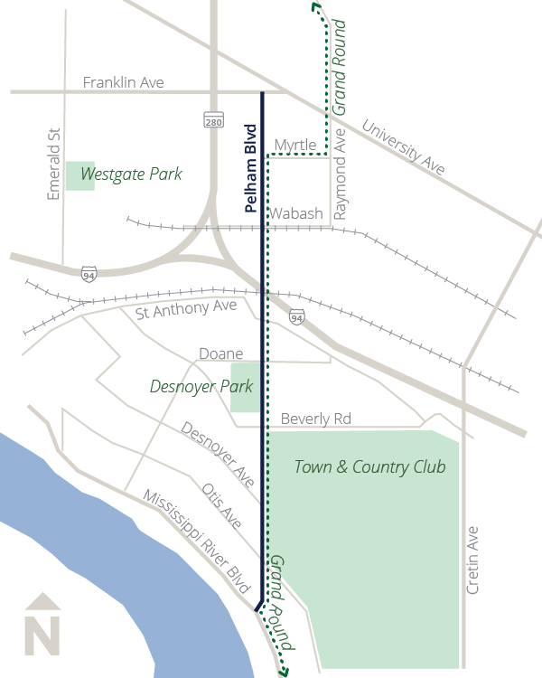
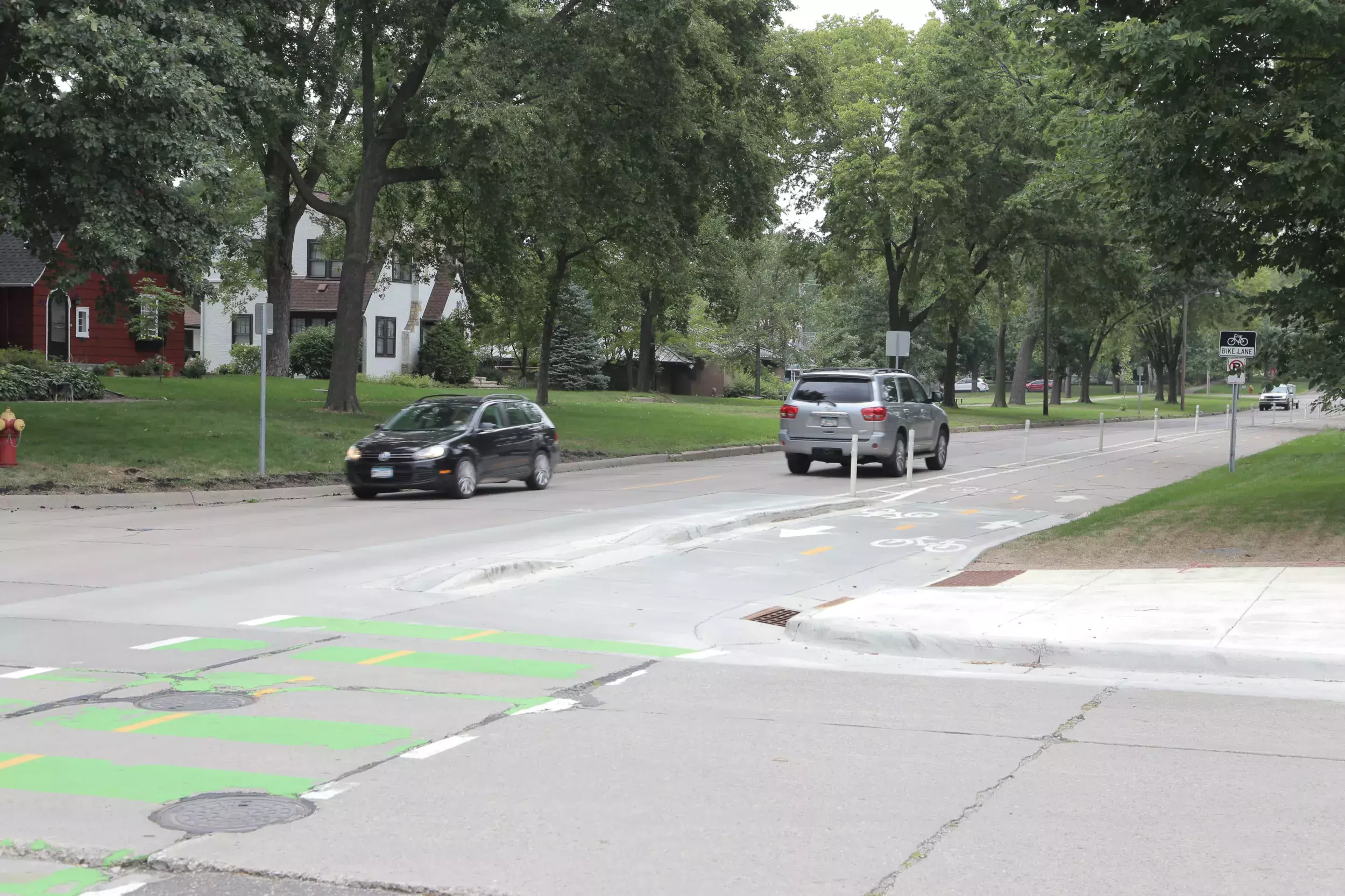
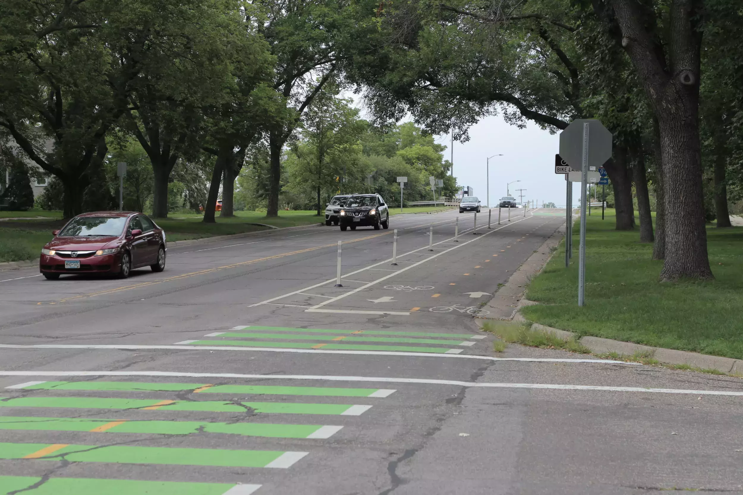
The width of the bikeway is planned to be 10 feet along all of Pelham, between Mississippi River Boulevard and Franklin. Where space is constrained north of I-94, the 6 foot sidewalk will be adjacent to the 10 foot bikeway.
What is the planned width of the car travel lanes?
Pelham will be reconstructed with two 11 foot travel lanes, and 1 foot gutters. At 24 feet wide, Pelham will be one of the narrowest collector streets in Saint Paul and is the same overall width as streets with 10 foot lanes and 2 foot gutters. Reducing the travel lanes to 10 feet was considered earlier in the project but was eliminated based on the overall width of the street (i.e., a street with no parking lanes). There is a concern that a 22 foot street would not function well in the winter when snow and ice piled on the curb tends to melt and encroach on the street. A 22 foot street also means catch basins (iron sewer inlet grates in the gutter) are one foot closer to the wheel path. Continued loads from vehicles driving on the catch basins cause the infrastructure to degrade faster and ultimately require maintenance and replacement sooner.
Have traffic impacts to other roads been determined?
Staff from Public Works Traffic Engineering Division have been heavily involved with all decisions related to intersection changes and traffic safety. Staff do not expect the project to impact the traffic patterns in the area in a significant way. The planned median at Doane will result in some revised traffic patterns in the immediate vicinity of the intersection but these are anticipated to be minor given the low traffic volumes on Doane.
Separate from this project, staff did receive an inquiry about the St. Anthony/Beverly intersection that is currently being reviewed.
Will emergency vehicles maintain access throughout the neighborhood?
City staff have shared current designs with the Saint Paul Fire Department and Emergency Services. There is no concern with emergency response with the current design, including the planned median refuge at Doane. These types of right-in-right-out medians have been built at several locations in Saint Paul (Fairview, south of Randolph, several locations along Maryland Avenue, Marshall Avenue east of Cleveland, Marshall at Dunlap). In an emergency, fire trucks are prepared to mount median refuges or briefly enter the opposite lane of traffic in order to access their destination.